North Wilkesboro's River Valley Profile: Why USACE Federal Authority and Yadkin Hydrology Change Everything
North Wilkesboro occupies Wilkes County's Yadkin River valley—a geological "bowl" carved by the river creating distinct terrain zones: Yadkin River bottomlands (elevation 900-1,000 ft—sandy loam floodplain with seasonally variable water tables rising/falling with river stage), surrounded by steep eroded hillsides (1,000-1,500+ ft elevation—Pacolet Series red clay with historical topsoil loss from agriculture and development). W. Kerr Scott Reservoir (completed 1962, 7,400+ acres at 1,030 ft full pool) dominates north/west areas—US Army Corps of Engineers (USACE) flood control project featuring flowage easements (federally-owned land strips extending 100-300 feet horizontal from full pool elevation where Corps controls land use prohibiting permanent structures). Unlike Duke Energy-managed lakes where utility owns TO certain elevation (property line AT water level), USACE flowage easements create federal ownership BANDS—property owners hold deeds to land but federal government controls easement zones for reservoir operations and flood management. This creates lakefront septic impossibilities—drainfields in easements violate federal law, repairs toward water prohibited, failures requiring expensive pump-to-uphill relocations. North Wilkesboro's NASCAR heritage (birthplace of stock car racing, home of legendary Speedway) reflects moonshine runners' mechanical creativity—that same engineering mindset applies to modern septic challenges requiring innovative solutions for federal restrictions and river valley hydrology.
- USACE Kerr Scott Flowage Easements = Federal Land Control: W. Kerr Scott Reservoir lakefront properties have flowage easements—federal ownership strips where US Army Corps of Engineers controls land use protecting reservoir operations. Property owners purchase land with deeds showing boundaries—but portions within flowage easement (typically 100-300 feet horizontal from 1,030 ft full pool) remain federally-owned. Owners have surface rights (can walk on land, maintain vegetation) but CANNOT construct permanent structures including septic drainfields, buildings, docks (except with federal permits), or any infrastructure interfering with USACE flood management authority. When lakefront systems fail, owners discover existing drainfields may be in flowage easements (installed before USACE enforcement tightened or without proper federal coordination). Repairs CANNOT expand toward water—federal law prohibits it. All replacements must go UPHILL away from easements requiring pump systems.
- Yadkin River Bottomland Seasonal Water Tables: Properties in Yadkin River floodplain (near Greenway, lower elevation areas below 1,000 ft) experience seasonally variable water tables tracking river stage. During dry seasons (summer/fall), river level drops—water tables recede to 4-6+ feet depth, systems work adequately. During wet seasons (winter/spring) or after heavy rain events, river rises—water tables elevate to 2-3 feet or surface, saturating drainfield zones. Yadkin River is NOT a stable lake—it's flowing river with stage fluctuations of 5-15+ feet seasonally. Drainfields installed at standard 24-30 inch depths sit in seasonally saturated zones during high water. This creates recurring wet-season failures resolving when river drops.
- Pacolet Eroded Clay Hillsides = Topsoil Loss Treatment Issues: Steep slopes surrounding Yadkin valley feature Pacolet Series red clay—originally productive agricultural soil but experiencing decades of erosion from farming, logging, and development. Topsoil (loamy surface horizon providing septic treatment capacity) washed away exposing red clay subsoil. This eroded profile PERCOLATES (clay has moderate rates 45-90 min/inch) but doesn't TREAT adequately (lacking organic matter, biological activity, structure true topsoil provides). Systems installed in eroded Pacolet subsoil fail prematurely (5-15 years) from inadequate treatment despite adequate percolation—biomat forms rapidly from partially-treated effluent depositing at soil interface.
Common Septic Issues in North Wilkesboro
1. Kerr Scott Lakefront USACE Flowage Easement Federal Restrictions
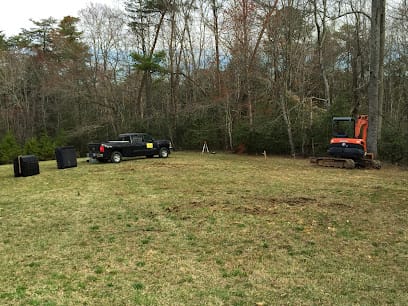
This is Kerr Scott's defining challenge—lakefront properties discovering failed systems in USACE flowage easements face federal restrictions prohibiting conventional repairs toward water, requiring expensive pump-to-uphill relocations. Your Kerr Scott lakefront property has spectacular reservoir views—house at elevation 1,050 ft (just above 1,030 ft full pool), private dock, waterfront lifestyle. The existing drainfield (installed 20-30 years ago) is failing between house and water—logical repair location near existing system. You apply for repair permit through Wilkes County Environmental Health. They inform you your property has USACE flowage easement extending 150 feet horizontal from full pool elevation. Your existing drainfield is within easement—as are ALL areas between house and water. Federal law prohibits new permanent structures in flowage easements. You CANNOT repair, expand, or replace drainfield in easement zone. All repairs must go UPHILL away from water—outside easement boundaries. Your house is at LOWEST suitable elevation—everything else is uphill. This is USACE flowage easement federal impossibility—lakefront repairs constrained by federal reservoir management authority. Symptoms aren't system failures—they're federal land use restrictions. Discovery of flowage easement boundaries during permit applications (property owners often unaware USACE controls portions of "their" land), inability to repair near existing systems (easement prohibits conventional repairs toward water), forced uphill pump relocations (only compliant option—waste must move away from federal-controlled easement), real estate complications (buyers discovering easement restrictions limiting future septic options), and costs 50-100% higher than conventional repairs ($15,000-$25,000 pump systems vs. $10,000-$15,000 conventional). Solutions require pump-to-uphill systems entirely outside easements: surveying flowage easement boundaries (USACE maintains official maps—must verify exact federal ownership limits before design), installing sewage ejector pumps at houses (lifting waste uphill away from lake), force mains running 200-500 feet uphill (to areas outside easement—typically near road/street level), drainfields at higher elevations (outside USACE-controlled zones), backup pumps/alarms (preventing failures), and federal coordination (although easement prohibits drainfields, USACE must be notified of work near reservoir—maintaining federal oversight). Unlike Duke Energy lakes where violations are utility enforcement, USACE violations are FEDERAL offenses—severe penalties, mandatory remediation, potential property liens. Contractors in our directory specialize in USACE Kerr Scott flowage easement compliance—surveying federal boundaries, designing uphill pump systems, coordinating with Wilkes County and Corps, and preventing the federal violations that create catastrophic legal/financial consequences for lakefront property owners.
2. Yadkin River Bottomland Seasonal Water Table Saturation
Properties in Yadkin River floodplain experience recurring septic failures from seasonally variable water tables tracking river stage fluctuations—working adequately during low water, failing during high water cycles. Your property near Yadkin River Greenway or lower-elevation bottomland areas (below 1,000 ft) has a system that works perfectly during summer and fall (dry seasons when river is low)—drains fast, no problems, no concerns. Then every winter and spring (wet seasons or after heavy rain), it starts: drains slow, wet spots appear in yard, system backs up. By June, everything resolves—systems work perfectly again. This cycle repeats annually for decades. This is Yadkin River stage-driven water table saturation—seasonal groundwater fluctuations tracking river level. The Yadkin is flowing river (NOT stable lake)—stage varies 5-15+ feet seasonally and 10-25+ feet during flood events. During low flow (summer/fall), river at elevation 920-940 ft, groundwater tables drop to 4-6+ feet depth, drainfields at 24-30 inches work adequately. During high flow (winter/spring/floods), river rises to 930-955+ ft, groundwater tables elevate to 2-3 feet or surface, drainfields sit in saturated zones—effluent cannot percolate through already-saturated soil. Symptoms include perfect dry-season performance / wet-season failures (water table tracking river stage creates predictable annual pattern), recurring problems after rain events (river stage rises quickly during heavy rain—groundwater responds within days), wet spots appearing without corresponding surface water (groundwater surfacing from elevated table—not rain puddles), and resolution when river drops (systems work again as groundwater recedes with river stage). The drainfield isn't failing from clogging—it's being submerged seasonally by river-driven water table. Solutions require elevated installation above seasonal high water: identifying seasonal high water table elevation (measuring during wet season or using soil indicators—mottling, gleying showing saturation depth), installing drainfields ABOVE high water (at 36-48+ inches depth if high water reaches 30 inches—or using mound systems elevating entirely above water table zone), mound systems (building drainfields UP 3-4 feet above natural grade using imported sand fill—entirely above seasonal saturation), pump-to-higher-ground (if property has areas above floodplain elevation—moving waste to upland locations with deeper water tables), or sewer connection (if municipal lines accessible—increasingly available in developed bottomland areas). Yadkin River properties require understanding of river hydrology—designing for HIGH WATER conditions, not average or dry season levels. Contractors in our network understand river stage impacts and design systems that work year-round—not just during favorable low-water periods.
3. Pacolet Eroded Clay Hillside Inadequate Treatment Failures
Steep hillside properties on Pacolet Series eroded red clay experience premature system failures from topsoil loss creating inadequate septic treatment capacity despite adequate percolation. Your hillside property (above Yadkin valley floor, elevation 1,100-1,400+ ft on slopes dropping toward river) has a system installed in what site evaluation identified as "red clay soil"—Pacolet clay percolating at 60-90 min/inch (adequate rates). Permits were issued. Installation occurred. Initially it works—for 5-15 years. Then premature failure: rapid biomat formation, wet spots, backups. Excavation reveals the problem: the "soil" is actually eroded clay subsoil—red sticky clay WITHOUT topsoil horizon. Decades of agriculture, logging, or development stripped protective topsoil layer exposing subsoil. This is Pacolet eroded subsoil inadequate treatment—percolation without biological processing. Healthy soil profiles have 12-18 inches loamy topsoil (high organic matter, active microbial biology) over clay subsoil. Topsoil provides primary septic treatment—microorganisms break down pathogens and nutrients before reaching clay. Eroded Pacolet has exposed subsoil at surface—minimal organic matter, limited biology, poor treatment structure. Effluent receives inadequate treatment, deposits organic matter at clay interface, and biomat forms rapidly (5-15 years vs. 25+ years in healthy topsoil). Symptoms include premature failures despite passing perc tests (tests measure percolation, not treatment capacity—eroded subsoil percolates but doesn't treat), rapid biomat formation (lacking biological buffering topsoil provides), recurring failures after repairs (if eroded soil conditions aren't addressed), and systems working initially but failing within 10-15 years (as inadequate treatment capacity is exceeded). Prevention requires topsoil replacement or augmentation: excavating eroded subsoil (removing 12-18 inches red clay lacking treatment capacity), importing loamy topsoil or suitable fill (sandy loam, organic-rich material meeting specifications—creating treatment zones above clay), oversizing drainfields (50-100% larger to compensate for marginal treatment capacity in remaining eroded subsoil), or using advanced pretreatment (ATUs, sand filters providing treatment independent of questionable hillside subsoil). Contractors in our directory recognize eroded Pacolet hillsides and don't assume red clay automatically means adequate treatment—performing deep profiling, identifying topsoil loss, and designing systems compensating for erosion-degraded soil conditions.
4. Speedway/Industrial Cut-and-Fill Disturbed Soil Compaction
Properties near North Wilkesboro Speedway and industrial parks sit on massive cut-and-fill grading—excavated material chemically compacted during development creating substrate that won't percolate despite appearing adequate. Your property near Speedway or industrial area was developed from former agricultural land that underwent extensive grading: large areas cut (excavated to lower grade), fill placed (imported material raising other areas to level), heavy equipment compaction (creating dense substrate for building foundations, parking, roads). Your lot appears to have "suitable red clay soil"—but it's actually disturbed reworked material compacted during grading. Site evaluation may show adequate-appearing soil. Then after installation, system fails immediately or within 1-3 years. Excavation reveals chemically compacted substrate—density approaching concrete, roots can't penetrate, water can't percolate. This is cut-and-fill disturbed soil compaction failure—artificial substrate created during development. Symptoms include systems failing immediately after installation (disturbed soil too dense for percolation), roots unable to penetrate drainfield areas (vegetation stress indicating compaction), standing water after rain (compacted substrate preventing infiltration), and complete replacement required (patching doesn't work when subsurface material is artificially compacted). Prevention requires deep evaluation of development history: researching property grading (determining if site underwent cut-and-fill), excavating deep test pits (exposing 36-48+ inches revealing disturbed compaction), performing compaction testing (measuring soil density—identifying artificial compaction exceeding natural levels), and designing systems for actual conditions (not assuming agricultural land automatically means suitable native soil). When disturbed compaction is discovered, solutions include complete substrate replacement (excavating compacted material—removing 24-36+ inches, replacing with suitable uncompacted fill meeting specifications), deep ripping and decompaction (mechanically fracturing compacted zones with heavy equipment rippers—breaking up artificial density), or system relocation (avoiding disturbed areas entirely—finding property zones that weren't graded during development). Speedway/industrial area properties require understanding of development history—recognizing cut-and-fill grading creates unsuitable septic substrate despite superficial appearance of "red clay soil." Contractors in our network investigate development history and don't assume site-altered land equals native soil conditions.
Complete Septic Solutions for North Wilkesboro Homeowners
- Septic Tank Pumping & USACE Flowage Easement Assessment: In Kerr Scott lakefront areas, contractors in our directory pump tanks every 3 years while assessing flowage easement implications—surveying USACE boundary locations (critical for future repair planning), documenting system position relative to easements (determining if existing drainfields in federal-controlled zones), identifying uphill pump requirements (if easements prohibit conventional repairs), and properly disposing of waste. Early easement boundary identification prevents permit application surprises when repairs are needed.
- Kerr Scott USACE Flowage Easement Uphill Pump Systems: For lakefront properties with drainfields in flowage easements or repairs prohibited toward water, contractors in our network design compliant uphill pump systems: surveying USACE flowage easement boundaries (obtaining official Corps maps showing federal ownership limits), installing sewage ejector pumps at houses (lifting waste away from lake), designing force mains running uphill (200-500 feet to areas outside easements—typically near road/street elevation), installing drainfields outside USACE-controlled zones (at higher elevations away from reservoir), coordinating with Wilkes County and Corps (ensuring federal compliance), and providing backup pumps/alarms (preventing failures). These are mandatory for Kerr Scott lakefront—federal law prohibits drainfield expansion in easements.
- Yadkin River Bottomland Elevated/Mound Systems: For properties experiencing seasonal water table saturation tracking river stage, contractors in our directory design elevated installations: measuring seasonal high water table (during wet season or using soil indicators—mottling showing saturation depth), installing drainfields ABOVE high water (at 36-48+ inches if high water reaches 30 inches), using mound systems (elevating 3-4 feet above natural grade entirely above water table zone using imported sand fill), or relocating to higher ground (if property has upland areas above floodplain with deeper water tables). These work year-round despite Yadkin River stage fluctuations—not just during dry-season low water.
- Pacolet Eroded Hillside Topsoil Replacement: For steep slopes with topsoil loss, contractors in our network provide treatment zone restoration: excavating eroded red clay subsoil (removing 12-18 inches lacking treatment capacity), importing loamy topsoil or suitable fill (sandy loam, organic-rich material creating treatment zones above clay), oversizing drainfields (50-100% to compensate for marginal remaining subsoil), or specifying advanced pretreatment (ATUs providing treatment before marginal hillside soil). These prevent premature failures from inadequate treatment in erosion-degraded profiles.
- Cut-and-Fill Disturbed Soil Deep Assessment: For properties near Speedway or industrial areas, contractors in our directory perform development history evaluation: researching site grading (determining cut-and-fill extent), excavating deep test pits (36-48+ inches exposing disturbed compaction), performing compaction testing (measuring soil density—identifying artificial levels), designing for actual conditions (not assuming agricultural land means native soil), and recommending substrate replacement or decompaction (when artificial compaction discovered). They understand site-altered land requires specialized evaluation—not standard agricultural soil assumptions.
- Yadkin River Stage Monitoring & Seasonal Timing: For bottomland properties, our directory includes contractors who understand river hydrology: monitoring Yadkin River stage (tracking USGS gauges showing current and historical levels), scheduling installations during low water (summer/fall when water tables receded—optimal construction conditions), designing for high water elevations (not average conditions—protecting against seasonal saturation), and educating homeowners on river stage impacts (explaining seasonal patterns preventing unrealistic repair expectations during wet seasons).
- USACE Flowage Easement Boundary Surveys: Before any Kerr Scott lakefront septic work, professional surveys identify federal boundaries. Our network coordinates licensed surveyors familiar with USACE easements—obtaining official Corps maps, surveying on-ground easement limits, marking boundaries clearly, and documenting for permits. This prevents federal violations from work in USACE-controlled zones.
- Moonshine Country Engineering Heritage Solutions: North Wilkesboro's NASCAR birthplace (moonshine runners' mechanical creativity) informs modern septic problem-solving. Contractors in our directory apply that same innovative engineering—designing creative pump systems navigating USACE restrictions, building elevated installations above river bottomland saturation, and solving impossible lakefront/river challenges with mechanical ingenuity reflecting moonshine hauler resourcefulness.
- Municipal Sewer Connection Coordination: When bottomland properties or constrained situations face impossible septic constraints, sewer connection provides relief. Our network coordinates North Wilkesboro municipal tap applications, designs gravity or pump connections, installs proper septic abandonment, and prevents permit delays extending projects.
- Real Estate Transfer Inspections (Wilkes County River Valley): Wilkes County requires septic inspections for property sales. North Wilkesboro inspections evaluate USACE flowage easement boundaries (measuring distances from Kerr Scott full pool—critical for lakefront properties), assess Yadkin River bottomland water table evidence (looking for seasonal saturation indicators), test Pacolet hillside soil conditions (identifying topsoil erosion), verify development history (near Speedway/industrial—checking for cut-and-fill disturbed soil), and identify federal compliance issues (systems in USACE easements face repair restrictions). Properties routinely reveal flowage easement violations, bottomland seasonal saturation, eroded hillside treatment inadequacy, or disturbed soil compaction. Our directory connects you with certified inspectors familiar with North Wilkesboro federal reservoir and river valley challenges and contractors for compliant solutions preventing months-long sale delays.